
Tilesets
OSM Shortbread Vector Tiles
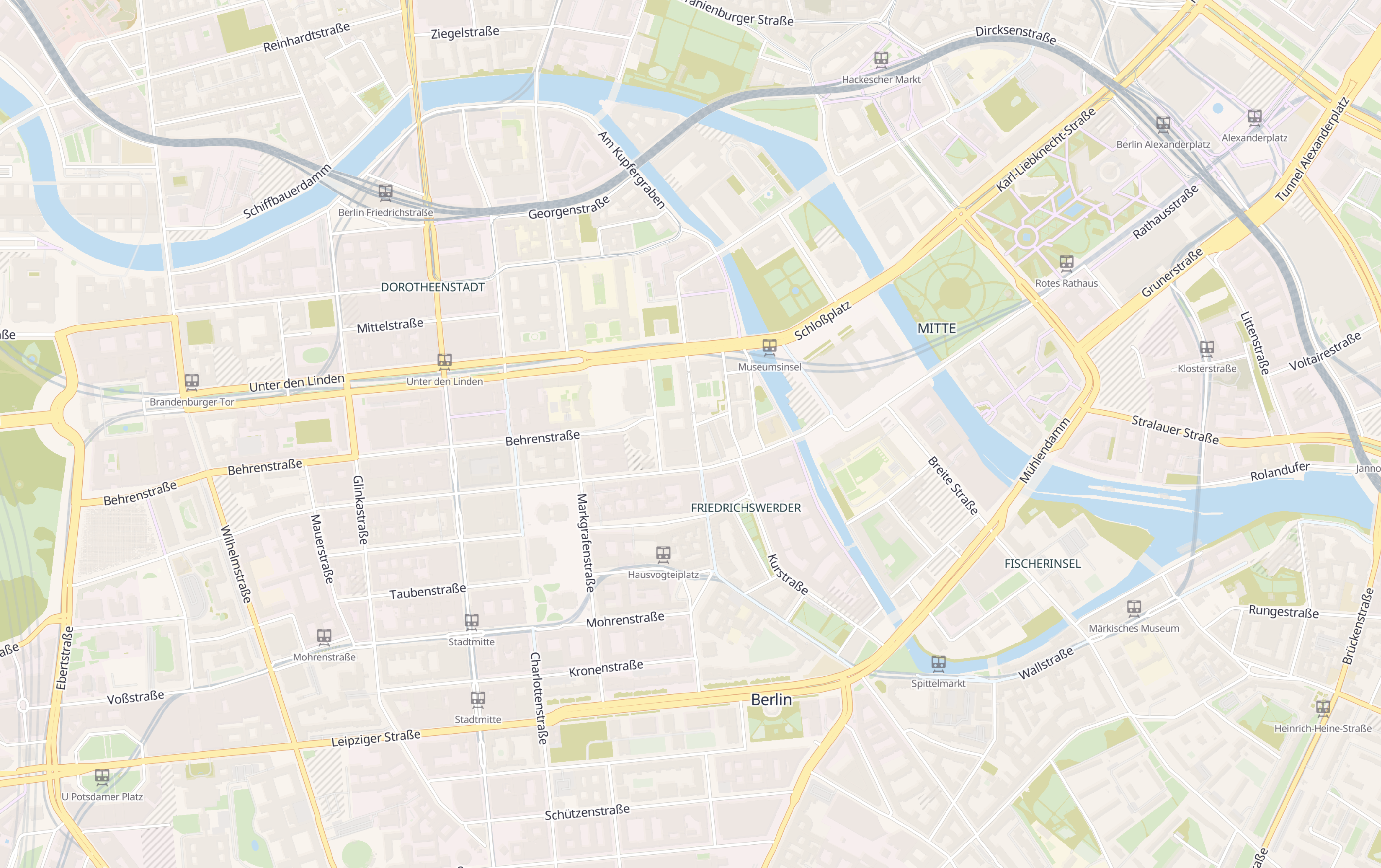
A set of general purpose vector tiles based on OpenStreetMap data using the Shortbread schema.
Style
There are several ready-made Public Domain styles available.
Licence & Attribution
- OpenStreetMap data is licensed under Open Database License 1.0 and requires attribution to OpenStreetMap contributors
- The Shortbread schema is licensed under CC-0 and does not require additional attribution.
Hillshade
A set of general purpose vector tiles for simulating a shaded relief. Based on Mapzen Jörð Terrain Tiles, inspired by Datawrapper
Style
There is one layer called hillshade-vectors with a property shade:
lightLight ShadesdarkDark Shades
Example
{
  // ...
  "sources": {
    "versatiles-hillshade": {
      "tilejson": "3.0.0",
      "name": "VersaTiles Hillshade Vectors",
      "description": "VersaTiles Hillshade Vectors based on Mapzen Jörð Terrain Tiles",
      "attribution": "<a href=\"https://github.com/tilezen/joerd/blob/master/docs/attribution.md\">Mapzen Terrain Tiles, DEM Sources</a>",
      "version": "1.0.0",
      "tiles": ["https://tiles.versatiles.org/tiles/hillshade-vectors/{z}/{x}/{y}"],
      "type": "vector",
      "scheme": "xyz",
      "format": "pbf",
      "bounds": [ -180, -85.0511287798066, 180, 85.0511287798066 ],
      "minzoom": 0,
      "maxzoom": 12,
      "vector_layers":[{ "id": "hillshade-vectors", "fields": { "shade": "String" }, "minzoom": 0 ,"maxzoom": 12 }]
    }
  },
  "layers": [
    {
      "id": "hillshade-light",
      "type": "fill",
      "source-layer": "hillshade-vectors",
      "source": "versatiles-hillshade",
      "filter": [ "all", ["==", "shade", "light"] ],
      "paint": {
        "fill-color": "#ffffff",
        "fill-opacity": { "stops": [[0, 0], [4, 0.2]] },
        "fill-antialias": true,
        "fill-outline-color": "#ffffff00"
      }
    },
    {
      "id": "hillshade-dark",
      "type": "fill",
      "source-layer": "hillshade-vectors",
      "source": "versatiles-hillshade",
      "filter": [ "all", ["==", "shade", "dark"] ],
      "paint": {
        "fill-color": "#000000",
        "fill-opacity": { "stops": [[0, 0], [4, 0.05]] },
        "fill-antialias": true,
        "fill-outline-color": "#00000000"
      }
    }
  ]
}
Licence & Attribution
- Mapzen Jörð Terrain Tiles (Access via AWS) uses variously licensed sources with attribution requirements
- The VersaTiles Hillshade Vectors tileset is licensed CC BY 4.0 carrying forward these attribution requirements
Landcover
A set of vector tiles based on ESA Worldcover satellite data. They fill in landcover detail at low and mid zoom levels where OpenStreetMap does not yet carry that information.
The tileset has received a major update — see the repository for details.
Downloads
Two download options are available:
- landcover-vectors.versatiles (1.9 GB) — Landcover tiles only; merge with an OSM tileset using the VersaTiles CLI.
- osm-landcover.versatiles (63.7 GB, Beta) — Pre-merged combination of OSM Shortbread vector tiles and landcover; ready to use without any further processing.
Style
There is one layer called landcover-vectors with a property kind:
bareBare / sparse vegetationbuiltupBuilt-upcroplandCroplandgrasslandGrasslandmangrovesMangrovesmossMoss and lichenshrublandShrublandsnowSnow and icetreecoverTree coverwaterPermanent water bodieswetlandHerbaceous wetland
Example
{
  // ...
  "sources": {
    "versatiles-landcover": {
      "tilejson": "3.0.0",
      "name": "VersaTiles Landcover Vectors",
      "description": "VersaTiles Landcover Vectors based on ESA WorldCover 2021",
      "attribution": "<a href=\"https://esa-worldcover.org/en/data-access\">© ESA WorldCover project 2021 / Contains modified Copernicus Sentinel data (2021)</a>",
      "version": "1.0.0",
      "tiles": ["https://tiles.versatiles.org/tiles/landcover-vectors/{z}/{x}/{y}"],
      "type": "vector",
      "scheme": "xyz",
      "format": "pbf",
      "bounds": [ -180, -85.0511287798066, 180, 85.0511287798066 ],
      "minzoom": 0,
      "maxzoom": 8,
      "vector_layers":[{ "id": "landcover-vectors", "fields": { "kind": "String" }, "minzoom": 0 ,"maxzoom": 8 }]
    }
  },
  "layers": [
    {
      "id": "landcover-bare",
      "type": "fill",
      "source-layer": "landcover-vectors",
      "source": "versatiles-landcover",
      "filter": [ "all", ["==", "kind", "bare"] ],
      "paint": {
        "fill-color": "#FAFAED",
        "fill-opacity": { "stops": [[0, 0.2], [10, 0.2], [11, 0]] },
        "fill-antialias": true,
        "fill-outline-color": "#ffffff00"
      }
    },
    // ...
  ]
}
Licence & Attribution
- ESA Worldcover is licensed CC BY 4.0
- The VersaTiles Landcover Vectors tileset is derived from ESA Worldcover and therefore also licensed CC BY 4.0
Bathymetry
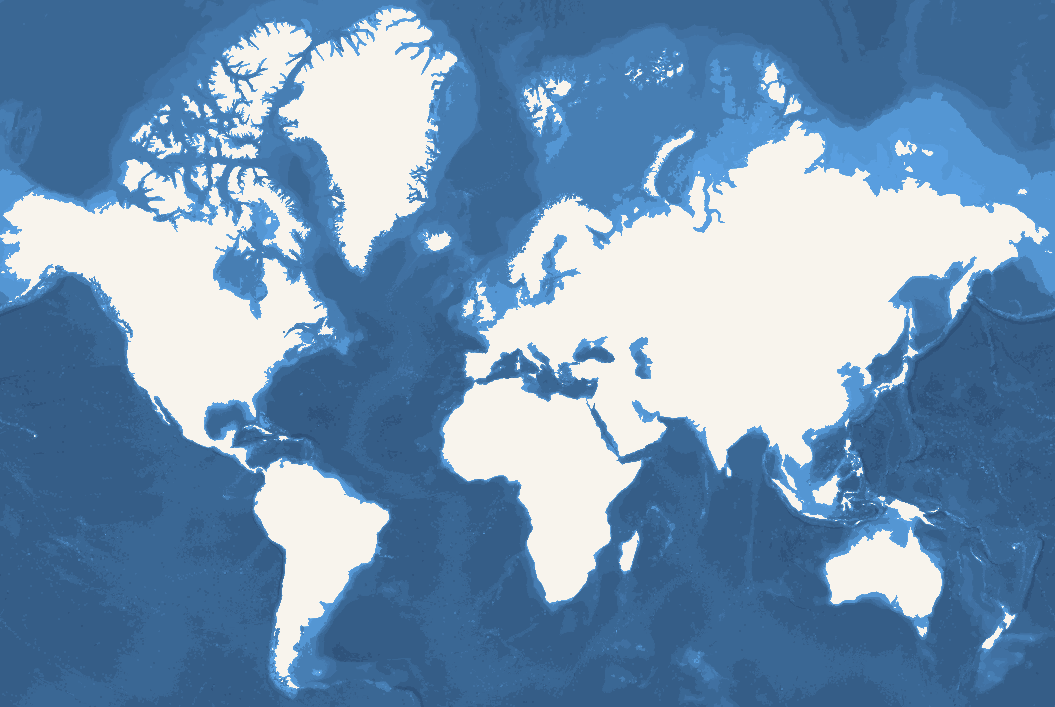
A set of vector tiles based on Bathymetry Shapefiles from OpenDEM
Style
There is one layer called bathymetry with a property mindepth with values
| Zoom | Depths |
|---|---|
| 0-5 | 100, 500, 2000, 6000, 8000 |
| 6-9 | 50, 100, 200, 500, 1000, 1500, 2000, 3000, 4000, 5000, 6000, 7000, 8000, 9000 |
| 10 | 25, 50, 100, 200, 250, 500, 750, 1000, 1250, 1500, 1750, 2000, 2500, 3000, 3500, 4000, 4500, 5000, 5500, 6000, 6500, 7000, 7500, 8000, 8500, 9000, 9500 |
Example
{
  // ...
  "sources": {
    "bathymetry-gebco-opendem": {
      "tilejson": "3.0.0",
      "name": "OpenDEM GEBCO Bathymetry",
      "description": "Bathymetry Vectors based on GEBCO 2021 derived contour polys provided by OpenDEM",
      "attribution": "Derived product from the <a href=\"https://www.gebco.net/data_and_products/historical_data_sets/#gebco_2021\">GEBCO 2021 Grid</a>, made with <a href=\"https://www.naturalearthdata.com/\">NaturalEarth</a> by <a href=\"https://opendem.info\">OpenDEM</a>",
      "version": "1.0.0",
      "tiles": ["https://tiles.versatiles.org/tiles/bathymetry-vectors/{z}/{x}/{y}"],
      "type": "vector",
      "scheme": "xyz",
      "format": "pbf",
      "bounds": [ -180, -85.0511287798066, 180, 85.0511287798066 ],
      "minzoom": 0,
      "maxzoom": 10,
      "vector_layers":[{ "id": "bathymetry", "fields": { "mindepth": "Number" }, "minzoom": 0 ,"maxzoom": 10 }]
    }
  },
  "layers": [
    {
      "id": "bathymetry-gebco-opendem",
      "type": "fill",
      "source": "bathymetry-gebco-opendem",
      "source-layer": "bathymetry",
      "layout": {
        "visibility": "visible"
      },
      "paint": {
        "fill-opacity": 1,
        "fill-antialias": false,
        "fill-color": ["case",
          ["==", ["get", "mindepth"], -25], "#0084bd",
          ["==", ["get", "mindepth"], -50], "#0181ba",
          ["==", ["get", "mindepth"], -100], "#017fb6",
          ["==", ["get", "mindepth"], -200], "#027cb3",
          ["==", ["get", "mindepth"], -250], "#0279af",
          ["==", ["get", "mindepth"], -500], "#0276ac",
          ["==", ["get", "mindepth"], -750], "#0374a8",
          ["==", ["get", "mindepth"], -1000], "#0371a5",
          ["==", ["get", "mindepth"], -1250], "#036ea1",
          ["==", ["get", "mindepth"], -1500], "#036c9e",
          ["==", ["get", "mindepth"], -1750], "#03699b",
          ["==", ["get", "mindepth"], -2000], "#036797",
          ["==", ["get", "mindepth"], -2500], "#036494",
          ["==", ["get", "mindepth"], -3000], "#036191",
          ["==", ["get", "mindepth"], -3500], "#035f8d",
          ["==", ["get", "mindepth"], -4000], "#035c8a",
          ["==", ["get", "mindepth"], -4500], "#035a87",
          ["==", ["get", "mindepth"], -5000], "#025783",
          ["==", ["get", "mindepth"], -5500], "#025580",
          ["==", ["get", "mindepth"], -6000], "#02527d",
          ["==", ["get", "mindepth"], -6500], "#025079",
          ["==", ["get", "mindepth"], -7000], "#014d76",
          ["==", ["get", "mindepth"], -7500], "#014b73",
          ["==", ["get", "mindepth"], -8000], "#014870",
          ["==", ["get", "mindepth"], -8500], "#01466c",
          ["==", ["get", "mindepth"], -9000], "#004369",
          ["==", ["get", "mindepth"], -9500], "#004166",
          "#0097d6"
        ]
      }
    }
  ]
}
Licence & Attribution
- The GEBCO Grid is placed in the public domain and may be used free of charge. Use of the GEBCO Grid indicates that the user accepts the conditions of use and disclaimer information.
- Attribution: Derived product from the GEBCO 2021 Grid, made with NaturalEarth by OpenDEM
Elevation
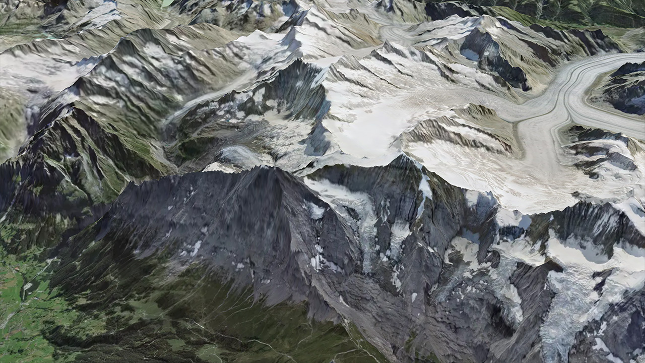
Global elevation data encoded as raster tiles in Terrarium format. The underlying DEM data is sourced from mapterhorn.com. To reduce file size by roughly 40 %, the elevation values are quantised before encoding — the resulting precision loss is visually unnoticeable for hillshading and 3D terrain.
Format
Each pixel encodes the elevation in metres as:
elevation (m) = (red × 256 + green + blue / 256) − 32768Style
Use it as a raster-dem source in MapLibre for hillshading or 3D terrain:
{
  // ...
  "sources": {
    "versatiles-elevation": {
      "type": "raster-dem",
      "tiles": ["https://tiles.versatiles.org/tiles/elevation/{z}/{x}/{y}"],
      "tileSize": 512,
      "encoding": "terrarium"
    }
  },
  "terrain": { "source": "versatiles-elevation", "exaggeration": 1.5 },
  "layers": [
    {
      "id": "hillshade",
      "type": "hillshade",
      "source": "versatiles-elevation",
      "paint": { "hillshade-exaggeration": 0.5 }
    }
  ]
}
Licence & Attribution
See the repository for the full list of data sources and their attribution requirements.
Satellite
Global satellite imagery composited from open data sources, available as raster tiles.
Style
{
  // ...
  "sources": {
    "versatiles-satellite": {
      "type": "raster",
      "tiles": ["https://tiles.versatiles.org/tiles/satellite/{z}/{x}/{y}"],
      "tileSize": 256
    }
  },
  "layers": [
    {
      "id": "satellite",
      "type": "raster",
      "source": "versatiles-satellite"
    }
  ]
}
Licence & Attribution
See the repository for the full list of data sources and their attribution requirements.